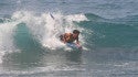
Knee high E short period wind swell for the morning going more ESE and building into the waist to chest range in the afternoon.
CONDITIONS
Sideshore texture/chop with ENE winds 10-15mph in the morning shifting E 20-25mph in the afternoon.
TIDES / SUN
AM
LOW5:33 am @ 0.3 ft
HIGH12:12 pm @ 4.4 ft
SUNRISE5:43 am
PM
LOW5:34 pm @ 0.9 ft
HIGHN/A
SUNSET8:26 pm
WIND
SWELL
WEATHER
6 am
WIND
SWELL
WEATHER
S 10 mph
ESE 0.7 ft @ 7 sec
9 am
WIND
SWELL
WEATHER
S 11 mph
S 1.5 ft @ 4 sec
ESE 0.6 ft @ 4 sec
12 pm
WIND
SWELL
WEATHER
SSE 16 mph
ESE 1.2 ft @ 7 sec
S 1.8 ft @ 4 sec
3 pm
WIND
SWELL
WEATHER
SSE 20 mph
SE 1.0 ft @ 8 sec
S 2.2 ft @ 4 sec
6 pm
WIND
SWELL
WEATHER
S 20 mph
S 2.5 ft @ 4 sec
SE 1.2 ft @ 7 sec
MONDAY
AM:
6-9 ft
CHOPPY
PM:
6-8+ ft
CHOPPY
SURF
Well overhead high SE ground swell.
CONDITIONS
Choppy with S winds 20-25mph in the morning shifting SSW for the afternoon.
TIDES / SUN
AM
LOW6:09 am @ 0.5 ft
HIGH12:08 am @ 4.7 ft
SUNRISE5:44 am
PM
LOW6:17 pm @ 1.1 ft
HIGH12:56 pm @ 4.3 ft
SUNSET8:26 pm
WIND
SWELL
WEATHER
6 am
WIND
SWELL
WEATHER
SW 6 mph
SSE 2.8 ft @ 6 sec
E 0.6 ft @ 6 sec
9 am
WIND
SWELL
WEATHER
SW 4 mph
SSE 2.6 ft @ 6 sec
12 pm
WIND
SWELL
WEATHER
SSW 8 mph
SSE 2.4 ft @ 7 sec
3 pm
WIND
SWELL
WEATHER
S 16 mph
SSE 2.3 ft @ 7 sec
6 pm
WIND
SWELL
WEATHER
SSW 17 mph
SSE 2.2 ft @ 6 sec
TUESDAY
AM:
4-6+ ft
CHOPPY
PM:
3-5 ft
CHOPPY
SURF
Chest to head high SE ground swell in the morning with occasional slightly overhead high sets. This drops into the chest to shoulder range for the afternoon.
CONDITIONS
Choppy/sideshore current with WNW winds 25-30mph.
TIDES / SUN
AM
LOW6:47 am @ 0.7 ft
HIGH12:51 am @ 4.4 ft
SUNRISE5:44 am
PM
LOW7:08 pm @ 1.3 ft
HIGH1:39 pm @ 4.4 ft
SUNSET8:25 pm
WIND
SWELL
WEATHER
6 am
WIND
SWELL
WEATHER
ENE 11 mph
SSE 2.2 ft @ 6 sec
9 am
WIND
SWELL
WEATHER
ENE 6 mph
SSE 2.6 ft @ 6 sec
12 pm
WIND
SWELL
WEATHER
SE 2 mph
SSE 2.7 ft @ 6 sec
3 pm
WIND
SWELL
WEATHER
ENE 4 mph
SSE 2.7 ft @ 6 sec
6 pm
WIND
SWELL
WEATHER
ENE 16 mph
SSE 2.6 ft @ 6 sec
WEDNESDAY
AM:
3-4+ ft
CLEAN
PM:
3-4+ ft
CLEAN
SURF
Waist to chest high ESE medium period swell with occasional shoulder high sets.