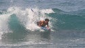
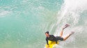
ACCURATE SWELLINFOSURF FORECASTS ON THE GO!
The Marin County, CA forecast has been added to your forecast favorite locations at the top menu bar.
CURRENT CONDITIONS
SURF FORECAST
SURF
SWELL
SURF GRAPH
SUN
MON
TUE
WED
THU
FRI
D-OH
O-Head
Head
Shoulder
Chest
Waist
Knee
6 ft
4 ft
2 ft
HEIGHT
- CLEAN
- FAIR
- CHOPPY
- SWELL 1
- SWELL 2
- SWELL 3
- SWELL 4
- SWELL 5
- SWELL 6
Forecast Updated: Sep 16 7:00 pm
Scroll over graph for data
Sat 7/12
Best Board for Today
WIND
mph
SWELLS
ft @ sec
---
SWELLS
7 DAY FORECAST
Click Day for Details
AM
PM
-
THURSDAYflatCLEANflatCLEANSURFMinimal (ankle high or less) surf.CONDITIONSClean with NE winds 5-10mph.TIDES / SUNAMLOW 7:57 am @ -0.6 ftHIGH 12:06 am @ 4.4 ftSUNRISE 5:55 amPMLOW 7:47 pm @ 1.9 ftHIGH 2:36 pm @ 3.4 ftSUNSET 8:35 pmWINDSWELLWEATHER6 amWSW 5 mphNW 0.0 ft @ 5 secWSW 1.4 ft @ 5 sec9 amWSW 4 mphW 2.1 ft @ 5 sec12 pmW 7 mphW 2.1 ft @ 5 sec3 pmW 11 mphW 2.1 ft @ 5 sec6 pmWSW 12 mphW 2.0 ft @ 5 sec
-
FRIDAYflatCLEANflatCLEANSURFMinimal (ankle high or less) surf.CONDITIONSClean with ENE winds 10-15mph.TIDES / SUNAMLOW 8:35 am @ -0.5 ftHIGH 12:48 am @ 4.2 ftSUNRISE 5:56 amPMLOW 8:36 pm @ 1.8 ftHIGH 3:12 pm @ 3.4 ftSUNSET 8:35 pmWINDSWELLWEATHER6 amWSW 8 mphW 2.6 ft @ 6 sec9 amW 7 mphW 2.6 ft @ 6 sec12 pmW 13 mphW 2.4 ft @ 6 sec3 pmWSW 14 mphW 2.5 ft @ 6 sec6 pmWSW 15 mphW 2.5 ft @ 6 sec
-
SATURDAY1 ftCLEAN2-3 ftCLEANSURFAnkle high SW short period wind swell in the morning builds to knee to waist high for the afternoon.CONDITIONSClean with ENE winds 10-15mph.TIDES / SUNAMLOW 9:11 am @ -0.2 ftHIGH 1:30 am @ 4 ftSUNRISE 5:56 amPMLOW 9:27 pm @ 1.8 ftHIGH 3:46 pm @ 3.4 ftSUNSET 8:34 pmWINDSWELLWEATHER6 amWSW 10 mphWNW 1.1 ft @ 6 sec9 amWSW 8 mphWNW 1.3 ft @ 6 sec12 pmWSW 9 mphW 2.0 ft @ 6 sec3 pmWSW 14 mphW 1.8 ft @ 5 sec6 pmWSW 13 mphWNW 1.2 ft @ 6 sec
-
SUNDAY4-6 ftCLEAN4-6 ftCLEANSURFHead high SW medium period swell.CONDITIONSFairly clean in the morning with E winds 5-10mph. Clean conditions for the afternoon with the winds shifting to the ENE.TIDES / SUNAMLOW 9:47 am @ 0 ftHIGH 2:12 am @ 3.7 ftSUNRISE 5:57 amPMLOW 10:23 pm @ 1.7 ftHIGH 4:19 pm @ 3.5 ftSUNSET 8:34 pmWINDSWELLWEATHER6 amWSW 10 mphWNW 1.0 ft @ 6 sec9 amWSW 8 mphWNW 1.0 ft @ 6 sec12 pmWSW 12 mphWNW 1.0 ft @ 6 sec3 pmWSW 15 mphWNW 1.0 ft @ 6 sec6 pmWSW 16 mphWNW 0.9 ft @ 6 sec
-
MONDAY4-6 ftFAIR4-7 ftCHOPPYSURFShoulder to head high SW medium period swell with occasional 1-2' overhead high sets.CONDITIONSSemi glassy in the morning with SE winds less than 5mph. Semi choppy conditions for the afternoon with the winds shifting SSE 5-10mph.TIDES / SUNAMLOW 10:24 am @ 0.3 ftHIGH 2:59 am @ 3.3 ftSUNRISE 5:58 amPMLOW 11:24 pm @ 1.5 ftHIGH 4:50 pm @ 3.5 ftSUNSET 8:34 pmWINDSWELLWEATHER6 amSW 7 mphWNW 0.6 ft @ 7 sec9 amSW 6 mphWNW 0.5 ft @ 7 sec12 pmWSW 9 mphWNW 0.5 ft @ 7 sec3 pmWSW 14 mphWNW 0.6 ft @ 7 sec6 pmWSW 15 mphWNW 0.5 ft @ 8 sec
-
TUESDAY3-4+ ftCHOPPY2-4 ftCHOPPYSURFStomach to shoulder high SW medium period swell for the morning drops into the waist to chest high zone during the afternoon.CONDITIONSBumpy/semi bumpy with SSW winds 5-10mph in the morning shifting S 10-15mph in the afternoon.TIDES / SUNAMLOW 11:00 am @ 0.7 ftHIGH 3:53 am @ 2.9 ftSUNRISE 5:58 amPMLOW N/AHIGH 5:22 pm @ 3.6 ftSUNSET 8:33 pmWINDSWELLWEATHER6 amSSW 8 mphWNW 0.7 ft @ 9 sec9 amSW 9 mphWNW 0.8 ft @ 9 sec12 pmSW 13 mphWNW 0.4 ft @ 9 sec3 pmSW 15 mphWNW 0.4 ft @ 9 sec6 pmWSW 14 mphWNW 0.3 ft @ 9 sec
-
WEDNESDAY4-6+ ftCHOPPY8-10 ftCHOPPYSURFChest to head high WNW long period swell for the morning with occasional slightly overhead high sets. This builds in the afternoon with sets up to double overhead high.CONDITIONSChoppy with S winds 15-20mph in the morning shifting SSE 20-25mph in the afternoon.TIDES / SUNAMLOW N/AHIGH N/ASUNRISE N/APMLOW N/AHIGH N/ASUNSET N/AWINDSWELLWEATHER6 amSSW 8 mphWNW 0.9 ft @ 9 sec9 amSSW 6 mphWNW 0.8 ft @ 9 sec12 pmWSW 15 mphWNW 0.8 ft @ 9 sec3 pmWSW 23 mphWNW 0.6 ft @ 9 sec
7 DAY TIDE CHART