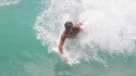
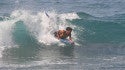
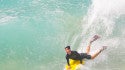
Quantcast
SwellInfo.com
     LOGIN | REGISTER
SwellInfo.com
Title Bar Seperator Title Bar Seperator Title Bar Seperator Title Bar Seperator Title Bar Seperator Title Bar Seperator Title Bar Seperator
SwellInfo.com Navigation
Spacer

MARTHAS VINEYARD, MA

clear 48 ° Ocean Temperature 68° Wind Calm
buoy data Buoy 44018
3ft @ 8sec
tide data 
Low: 11:58 AM
High: 5:37 AM

leftcrv spacer

DETAILED SURF FORECAST

  change
spacer
help
rtcrv
BEACH FACING DIRECTION 
SESW
Swell Info Surf Reports Spacer
Bookmark and Share ICON LEGEND
  AM PM
Today rss feed    
Surf: Waist high mix of SW short period wind swell and SSE wind swell for the morning drops a bit in the afternoon.
Conditions: Light sideshore texture in the morning with WNW winds 5-10kt. Semi glassy conditions for the afternoon with the winds shifting W less than 5 kt.
Swell Info Surf Reports Spacer
Tuesday    
Surf: Ankle to knee high SSE short period wind swell for the morning going more SW during the day.
Conditions: Bumpy/choppy with SW winds 10-15kt in the morning increasing to 15-20kt in the afternoon.
Swell Info Surf Reports Spacer
Wednesday    
Surf: Waist high SW short period wind swell for the morning with occasional stomach high sets. The swell builds in the afternoon with sets up to chest high.
Conditions: Choppy with SW winds 20-25kt.
Swell Info Surf Reports Spacer
Thursday    
Surf: Ankle to knee high SW medium period swell for the morning going more SSW during the day.
Conditions: Sideshore/choppy with WNW winds 15-20kt in the morning shifting W for the afternoon.
Swell Info Surf Reports Spacer
Friday    
Surf: Knee to thigh high mix of W short period wind swell and SE ground swell.
Conditions: Sideshore/choppy with WNW winds 15-20kt in the morning decreasing to 10-15kt in the afternoon.
Swell Info Surf Reports Spacer
Saturday    
Surf: Knee high SE ground swell with occasional thigh high sets.
Conditions: Fairly clean in the morning with NW winds 5-10kt. Bumpy/semi bumpy conditions for the afternoon with the winds shifting to the SW.
Swell Info Surf Reports Spacer
Sunday    
Surf: Knee to thigh high SW short period wind swell for the morning with occasional waist sets. The surf builds from the SSW into the waist to stomach range for the afternoon.
Conditions: Choppy with SW winds 15-20kt in the morning shifting WNW 10-15kt in the afternoon.
Swell Info Surf Reports Spacer
**Surf Height Definition**
Forecasted surf heights represent a potential wave face height for the average to better breaks in a region during optimal conditions (tides,wind,swell).
Swell Info Surf Reports Spacer
Forecast updated: Sep 5, 2010 6:59 PM ET

SWELL TABLE WEATHER FORECAST TIDE CHART WIND TABLE


spacer
leftcrv spacer

SURF REPORTS

spacer rtcrv
LocationWv Ht Cond'sPosted
Southampton, NY3 ftphoto surf report9/5
Gilgo Beach, NYcamphoto surf report9/5
Gilgo Beach, NYcamphoto surf report9/4
Southampton, NY3-5 ftphoto surf report9/4
Gilgo Beach, NYcamphoto surf report9/4
Long Beach, NY
8-10+ ft9/3
click or mouse over location for details | more surf reports

spacer
leftcrv spacer

NORTH EAST FORUM

spacer
POST    
rtcrv
Latest Entries User Post
wownickzilla7209/5
A few words on EarlMFitz739/5
OCMD Danielleswell59/4
Danielle pixswell59/3
Hurricane Fionaspackledust9/3
my name iz earl...Shogun10119/1
Board for saledileer9/1

SURF PHOTOS

UPLOAD
Montauk 
Ecsc 2010 
Ocmd Sunday Sept 5 
Cutback 
MontaukEcsc 2010Ocmd Sunday Sept 5Cutback

SURF VIDEOS

SUBMIT
Hurricane Earl DelawareSurfing Earl in DelmavaHolden Beach 9-2-2010Vince Boulanger- "Hurricane Earl"

NEWS

ADD
No end in sight for Tropical Swells
Danielle smaller than anticipated in the Northeast #%!?
Hurricane Danielle Video Bulletin

leftcrv spacer

ATLANTIC TROPICAL SYSTEMS

OUTLOOK SATELLITE DISCUSSION rtcrv
System Name
(From Last Advisory)
Last Advisory Date
(UTC)
Position Direction
 
Speed
mph (kts)
Pressure
mb (in)
Winds
mph (kts)
Lat Lon
TROPICAL DEPRESSION TEN 0600 UTC MON SEP 06 2010 20.9N 95W N 7 (6) 1003 (29.62) 34.8 (30.3)


Copyright 2006-2009 Swellinfo. Use of this site is subject to the following Terms and Conditions and Privacy Policy.